


The White Mountains Trail System is a perfect example of undiscovered opportunities. Centered in the Show Low/Pinetop-Lakeside area, more than 200 miles of trails have been developed by TRACKS, a dedicated group of volunteers in cooperation with the towns and the U.S. Forest Service. It's a beautiful network of well-designed trails, mostly built as loops and spoked with connectors allowing for a wide range of options. For a hiker on a quest, that's irresistible.
Ice Cave Trail
The Forest Service calls this the Blue Ridge Cave Trail, but it’s also widely known as the Ice Cave Trail. It delivers a big dose of all there is to love about hiking around Pinetop-Lakeside in a couple of action-packed miles.
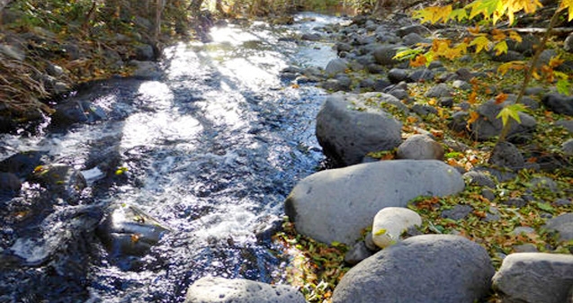
Starting out, the official trail immediately bears right, following a line of telephone poles for a quarter-mile before connecting to Porter Creek. There’s also a very obvious use trail that leads directly to the creek, and everyone walked that way the day I was there. TRACKS plans to reroute this stretch of trail when it gets the go-ahead from the Forest Service.
Porter Creek is a lazy channel winding through a meadow at the edge of the pines. The trail soon peels away from the creek, cutting through mixed timber where it emerges on the banks of Scott Reservoir. The 80-acre reservoir seems bigger because it appears so suddenly. Abundant and unexpected water is part of the charm of the White Mountains.
After skirting the reservoir, the trail curls back into the woods. The path is obvious but rocky in places. As with all trails designed by TRACKS, blue diamond markers posted on trees at regular intervals provide an easy-to-follow guide. At 1.5 miles, the Osprey Connector links to the Ice Cave Trail. The turnoff for the ice cave is a half-mile beyond this point and is one of the few junctions in the TRACKS network without a sign, so keep alert.
A wickiup of poles marks the turnoff to the cave, which actually is a lava tube with a constant flow of cool air (about 52 degrees). It’s the next best thing to stumbling onto a Dairy Queen in the middle of the woods. A chain-link fence surrounds the cave, but the gate was open wide.
I sit for a long time on a rock, enjoying a full frontal blast of cool air. What luxury for a desert hiker. If all the trails around here are this plush, they may not be able to get rid of me. I’m used to hiking where the heat throttles me and the sun wilts my bones. Here is a trail that offers not only shade and water but air-conditioning. I doze off, dreaming that I’m eating soft-serve ice cream with Eskimos.
Where: From the Lakeside Ranger District office, 2022 W. White Mountain Blvd., drive 0.2 mile southeast on Arizona 260. Turn left on Porter Mountain Road and go 1 mile. Trailhead is on the right.
Length: 4 miles round trip to the lava cave.